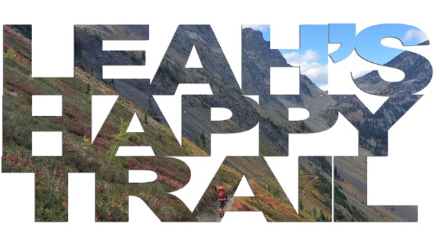

The Southern Appalachian Loop Trail (SALT) is a 350-370 ish mile trail that includes the Appalachian, Bartram, Foothills, Mountains to Sea, and Art Loeb trails. The loop traverses four states: NC, TN, SC, and GA. The loop is hard.
First section: 75 miles, 4 days, AT and Bartram Trail
[I drew elevation profiles in my nightly journal on this trip. As you can see, there is no scale, so I just drew them to represent what the day felt like to me. Enjoy!]

The rain began as a light drizzle just an hour into our first day on the SALT. A few days before Seth and I embarked on the loop, my dad sent a text to warn us of the potential for rainstorms during the first section of our hike due to tropical storm Alberto moving up the coast. The day before we started, he updated his warning to include words like “HEAVY RAINFALL” and “are you sure.” Undeterred, we found ourselves hiking southbound on the Appalachian Trail reassuring ourselves that the drizzle really wasn’t all that bad. We delayed putting on our clear plastic ponchos until the drizzle turned into steady rain. Unbeknownst to us, these ponchos would be a mainstay for the next three days…

Enjoying misty views
We began the day hiking the 18 mile AT section from the Nantahala Outdoor Center to the junction with the Bartram Trail. It was a relaxing start to the loop, since we’re quite familiar with this section of trail due to numerous long runs in the area. Additionally, we took advantage of two AT shelters along the way to take snack breaks, as they provided a brief refuge from the rain (and a toilet, let’s be real). There were upwards of twenty northbound hikers on this stretch who we enjoyed greeting and chatting with before continuing to hike.
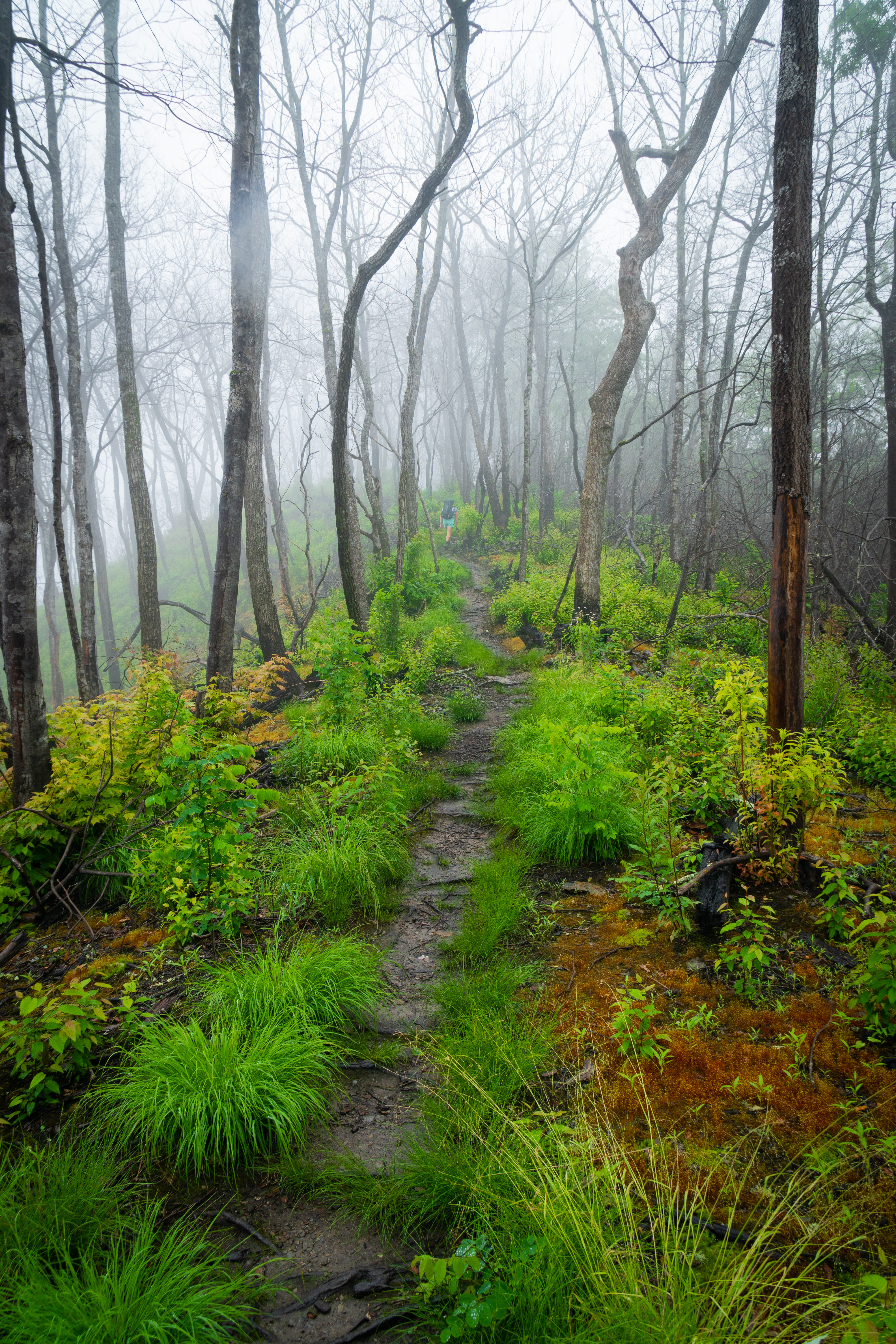
The ever colorful AT
We took a “lunch” break at the Wayah Bald Shelter – I didn’t wear a watch on this trip, so I didn’t find out until I asked that our lunch break was actually at 3pm. Anyways, the vibe in the shelter was…odd. There were five zombie humans tucked in their sleeping bags snoozing the day away while their poor dog was laying on the shelter floor damp and shivering. We tucked away in a corner and covered our legs with the tent body to eat lunch as it was chilly. Little did we know, these zombie hikers would be the last hikers we would see on trail for the next four days.

After lunch, we bid the AT farewell and turned onto the Bartram. And then promptly got lost. The yellow Bartram blazes disappeared during a burned section of trail, and we turned around when we were concerned that we’d accidentally diverged from the trail. After tromping back and forth through a steep quarter mile corridor of stinging nettles three times, we realized that we’d been on trail all along. Over the next four days that we were to spend on the trail, this wouldn’t be the last time that the poorly blazed Bartram would get the best of us.

Walgreen’s poncho perhaps not intended for backpacking
In addition to navigation, a new problem presented itself during the afternoon of the first day: my pack. I started the trip excited to try out a new pack, the Ultimate Directions Fastpack 35. I’d worn it for an overnight trip a couple of months ago and it performed great. However, the pain that began in my shoulders and soon radiated down to my hands indicated that something wasn’t right. I’d loaded the pack down with five days of food, and it became clear that the pack simply isn’t equipped to handle that kind of load since it lacks load lifters and a functional hip belt. We tried all kinds of adjustments to the pack straps and the way I had my gear packed, all to no avail. I resigned myself to just being uncomfortable until the food weight decreased later on in the stretch of hiking.

Huge tree! My shoulders hurt!
The search for a campsite that night proved to be unexpectedly difficult, since the Bartram resembles a wild jungle this time of year. A few campsites that were marked on our map must have been winter/spring/fall campsites, because in the peak summer greenery they simply didn’t exist. After slogging up and down repeated steep pitches for an hour, we found ourselves a nice campsite next to a creek at 8:30pm. We took advantage of a luxurious break in the rain to cook our dinner while lounging on sleeping pads adjacent to the tent. Just as the water was about to boil, we heard the unmistakable sound of quickly approaching pouring rain. Cursing, we scrambled to get all of our food inside the tent before the deluge. I dove in with armfuls of gear and food, while Seth took one for the team and got completely drenched collecting the remaining items. The Bartram certainly got the last laugh on day one.

We began the morning with a few trail miles, and then the ten mile road walk section of the Bartram began. We walked down into Franklin and spent almost an hour sitting on the ground in front of a gas station delighting in a deli sandwich, among other things. We finally continued on, only to stop at a Zaxby’s for some chicken tenders a mile on down the road. So much for efficient hiking.

Gas station donuts are an essential component of any thru hike
Fortified by junk food, we kept on walking down the two lane country road. The highlight of this section occurred when we walked by a field of cows while wearing our ponchos. The cows must not have been able to tell what we were with the ponchos on, because all ten or so of them ambled over to the fence to look at us. Seth put out his hand and one brave cow walked forward, took a long sniff of his hand, and snorted. Then one more cow did the same thing. I think they were disappointed to find out that we were just humans after all!

I love cows!!!
When we figured it was just about time for the road walk to be ending, we noticed yellow blazes leading up a driveway and into the woods. Welcome back to the Bartram! We ate a snack in the stranger’s driveway and chuckled at the lack of signage for this trail. Even though the next section was hard, steep hiking, we both marveled at how cool the trail was. The fields and fields of leafy bushwhacking sections on the mountainside led us to question when the last time anyone had hiked there. It truly felt wild. The countless beds of poison ivy provided me with enough practice to finally feel confident in identifying it (only took me 25 years).

Playing a game called “How many poisonous plants can I touch with my legs”
Our map included an attraction on trail called “The Bus.” I was hoping it was a large rock shaped like a bus, but unfortunately it turned out to be an old NC Public Schools bus. Abandoned! On an overgrown mountain ridgeline! I thought it was terrifying. Seth wanted to take a snack break IN it. For the whole afternoon and early evening of hiking, we’d enjoy brief fifteen minute intervals without rain. Then we’d see a gray wall approaching, and another band of rain storms would continue the deluge.

The shoulder pain from my pack was so bad throughout the day that I ended up transferring some of my items to Seth’s pack (a well constructed 60L). For part of the afternoon we switched packs, and his significantly heavier pack was much more comfortable than my little Fastpack. Blargh.
Our campsite for the evening, located on a hyper green misty ridgeline, looked eerily similar to our campsite the night before. This made it seem like the Bartram was playing tricks on us and we hadn’t made any progress at all. We cooked dinner in the tent and then drifted asleep, hoping for sunshine the next day.

We awoke periodically throughout the night to heavy rainfall, and unfortunately the rain continued in the morning. We took our time eating breakfast in the tent, since it seemed like the rain was coming in 40 minute bands. During a lull, we hopped out of the tent, packed our gear, and continued up the trail. We started hiking optimistically, but Day 3 would turn out to be a doozy.

Ah, tent breakfast. We’ve all been here before.
We spent most of the morning climbing up to Scaley Mountain, a random mountain rife with false summits. Even though there were no views due to the cloudy weather, we took a lunch break atop the rocky summit. Since the rain had momentarily stopped, we decided to chance it and make ramen (yum!). As was our luck, just as we started eating the rain began again. Picture this: both of us sitting on sleeping pads, legs tucked beneath ponchos, eating bowls of ramen in the pouring rain. It was raining so hard that spicy broth splashed into my eyes! If we had any dry food or gear items left at this point, now they were soaking wet. The ramen really lost its intended morale boost once the rain began.

Seth finds a turtle on the trail!
The second setback of the day occurred when we hiked the two miles down to a road crossing. We felt like we had been hiking strong and crushing the day. We hadn’t taken a break until lunch, so there was no way we couldn’t have been making good time. Wrong. As we expectantly added the miles up on the map posted by the road trailhead, we realized that we had only gone 8.5 miles by 3 pm. How could we possibly expect to cover 25 miles today? Cue doom and gloom.

Believe it or not, we considered this “nice” weather since it wasn’t raining
The next section of trail had many waterfalls, but we couldn’t properly enjoy their beauty due to the incredibly slippery bridges we had to cross. The constant rainfall made the bridges slick like ice, so we had to slow down and carefully slide our feet across while holding onto the railings. How could a trail so close to the road have such treacherous features? The only answer we could come up with is well, it’s the Bartram.
Hiking steadily for the rest of the afternoon, we decided to give up and camp for the night just short of Rabun Bald. We hurriedly set up the tent during a thunderstorm, walked down the steep hillside to get water, and then jumped inside. Everything was wet. Everything. Puddles on the floor of the tent. Food wet. Hiking clothes soaked. In a moment which we now laugh about, but at the time was devastating, we took off our drenched hiking clothes and sat on the wet sleeping pads amid all of our soggy gear listening to the pouring rain. With a flourish intended to lighten the mood, Seth pulled out one pair of dry wool socks. The last dry item!!! We each took one and used it to dry ourselves off. I found myself at my upper limit for gross-ness, so we formulated a plan to bail to town the next day. We eventually fell asleep to thunder and the hardest rain I’ve ever heard in a tent.

The low point of the morning was having to put on all of our dirty, soaking wet hiking clothes again. We packed away all of our wet things and then finished the climb up to Rabun Bald. We had a good amount of food left, so I looked at our PDF data sheet and formulated a plan that I thought would allow us to skip hitching to town and keep us on schedule. I thought I’d seen something called the Warwoman Deli on our PDF located at the highway crossing to town. We could eat a big dinner at the deli, dry off a bit, and keep on hiking without having to waste time hitching! I was very excited about my plan. After I explained it to Seth, however, he very gently burst my bubble and told me that it was actually called Warwoman Dell…no deli. Woops!
The hiking was relatively easy for the Bartram to get us down to the highway. Even though my pack couldn’t have been more than 15 or 20 pounds, the horrible shoulder pain still continued to bother me. Additionally, I started feeling a weird pinpricking sensation on my back and hips. We later figured out that it was heat rash due to the pack being pressed against my back all day long, but at the time I wrote it off as an odd unpleasant sensation and kept on hiking.

Get me out of this pack!!
When we were about an hour out from the highway, we switched packs to give my shoulders a break. The next section was going to be another long five day resupply, so we brainstormed ways we could make my pack work. There really were no good options. Instead, we came up a with a crazy plan.
Once we hitchhiked into Clayton, GA, we checked into the Days Inn and promptly emptied my pack. Without skipping a beat, we walked to the post office and mailed the pack home! Our plan? To pack all of our gear and five days of food for both of us into Seth’s 60L pack. Over the next five day section we would take turns carrying the pack while the other person hiked without any pack on.
What could go wrong?? Stay tuned for The SALT – Chapter 2.
Seth took all of the great pictures in this blog post! Check out his photography website here. I took all of the poor quality iPhone pictures. I don’t have a photography website, sorry.


Holly D
June 21, 2018 at 11:38 pmThoroughly enjoy reading your blog!
Leah Ling
June 22, 2018 at 6:25 amThanks for reading Holly!!
Cap
June 22, 2018 at 11:39 amSomeone should really put a deli up there…