
With only 144 miles left to a victorious conclusion of the SALT, we were happily anticipating the glory of the Smokies. But we did not expect wild boars, bull elk, lost hikers, oh my. Read on, my friends.
The Southern Appalachian Loop Trail (SALT) is a 350-370 ish mile trail that includes the Appalachian, Bartram, Foothills, Mountains to Sea, and Art Loeb trails. The loop traverses four states: NC, TN, SC, and GA. The loop is hard.
Third section: 144 miles, 7 days; Bracken Mountain Trail, Art Loeb, Mountains to Sea Trail, Blue Ridge Parkway, Great Smoky Mountains National Park (Mingus Creek Trail, Sunkota Ridge Trail, Deep Creek Trail, Fork Ridge Trail), AT
[Do you feel like you’re starting this story somewhere in the middle? Check out Chapter 1, or perhaps Chapter 2.]

After a relaxing morning spent eating breakfast and dessert at the Sunrise Café, then running errands around Brevard, we found ourselves lounging on the sofa at a friend’s house. While watching Seth’s favorite movie, the Adventures of Tintin, we heard a low rumbling approaching. Seth jumped off the sofa and ran to the door – a new pack had been delivered! Thanks to Seth’s longstanding relationship with Granite Gear, they were nice enough to send me a Crown2 38L. It would turn out to be the perfect sized pack for my backpacking needs, and delightfully comfortable. I excitedly packed all my gear inside, and soon we were off walking down the road with two packs instead of just one!
We had to walk the three miles to downtown Brevard to pick up where we left off on the SALT since all our friends were at work like good upstanding citizens. The walk went by quickly, and after snarfing a quick cheeseburger and root beer float, we rejoined the SALT around 6pm. It felt quite novel to walk straight through downtown and then out of town to the Bracken Mountain Trail. We stepped aside for mountain bikers getting their weeknight runs in as we leisurely chugged our way up to the Art Loeb.
It was an incredibly pleasant evening, even though my right calf was hurting a lot. A lot a lot. So much that a few times I considered stopping abruptly and walking back down to Brevard to drop from the loop. I kept hiking, however, and eventually we made it to a campsite on the Art Loeb just after sunset. Seth did some active release methods on my calf, I took an Advil, and we fell asleep.

I awoke in the dark predawn to a loud crash, signaling that Seth had accidentally pulled off a sizable tree branch while lowering the bear hang. To keep it real for women in the wilderness everywhere, I will share this: as I relieved myself that morning, I realized that I’d developed a UTI. I won’t mention it again in this narrative, but just know that I dealt with that thing for the rest of the trip, and it didn’t clear up until two weeks later when I finally caved and sought out a doctor.
We quickly packed up camp, had coffee and breakfast, then set off on the Art Loeb. Since I’ve lived in North Carolina for my whole life thus far, I’ve been lucky to have hiked on the Art Loeb numerous times over the past ten years. As such, I was anticipating the big climb up to Pilot Mountain, and the glorious spruce aroma atop the Balsam Ridgeline (I can still smell it right now while writing this).

Sweaty Pilot Mtn summit
The calf pain that had been plaguing my hiking for two days prior was miraculously gone! I traversed uphill, downhill, and rocky terrain completely pain free. It seemed too good to be true, but I didn’t question it, and certainly didn’t take it for granted.
Once we crossed the Blue Ridge Parkway, we departed from the Art Loeb and turned on to the Mountains to Sea Trail (MST). The MST is a 1175 mile route that starts on Clingman’s Dome in the Great Smoky Mountains National Park and terminates on top of Jockey’s Ridge at the Outer Banks. We’d be following it from the Art Loeb junction to Clingman’s Dome and were excited to check out a uniquely NC trail.

My goodness
We stopped for lunch in a spooky wooded section shortly after joining the MST. I distinctly remembered this little forest from an 8th grade mountain trip. I didn’t really enjoy backpacking or hiking back then, so I was amused to find myself in the same spot over ten years later, but this time wholeheartedly enjoying the activities that brought me there.

A quiet moment of reflection before stuffing my face with processed foods
On the PCT I always packed a dedicated lunch in my food bag, whether it be peanut butter and jelly tortillas, summer sausage and cheese tortillas, instant mashed potatoes, instant pasta/rice dish, or ramen. On this trip I decided to try out the snack method for lunch – instead of bringing lunch foods, I packed double the snacks and ate them for lunch. During the first week I found this to be quite fun. Basically, you allow yourself to go crazy and eat three snacks in a row, which is very entertaining if you’re voraciously hungry. But by Day 11 it’d come back to bite me. After dipping a pack of Belvita breakfast cookies in almond butter and eating Nabs cream cheese and chives crackers, some crushed Sun Chips, a Luna bar, and a Walker’s shortbread cookie, it should come as no surprise that I didn’t feel good. I sluggishly packed up and set off down the trail, feeling a little nauseous and generally icky due to all the processed foods.

The MST took us straight into the Middle Prong Wilderness, though we didn’t know what it was at the time. We followed a relatively flat trail that soon became so twisty and forested that I lost all bearings. There were no blazes for the MST in this section, resulting in us briefly taking a wrong turn. We finally emerged on the Blue Ridge Parkway and sat on a wooden railing for a snack break. After a quick tally, we were disappointed to find out that we had only hiked 20 miles by 5pm. Watching the occasional car go by, we calculated our remaining mileage and determined that we’d be able to finish the loop by our deadline, but just barely. We had to make it home in time to turn around and drive down to Florida for my good friends Anays and Ryan’s wedding. Exciting times!
The remaining miles for the day were uneventful, since the MST wrapped around the side of the parkway ridgeline and hummed along an old forest service road covered in nettles, jewel weed, and various other greeneries. At this point we were a bit disappointed by this section of the MST; I’d been expecting a unique, scenic trail connecting the Art Loeb to the Smokies and instead we were served with the kind of trail that makes your brain turn off.

At this point in the trip, I’d amassed over 3000 cumulative lifetime thru-hiking miles. (What is thru-hiking?) That might make it seem like I’ve figured everything out by now and diversifying my backpacking strategies is unnecessary, but the opposite is true. The more I hike, I seek out ways to make moving through the outdoors even more enjoyable, whether that be through talking with others, or this introvert’s specialty of the house, introspection. As such, on this morning I discovered the best backpacking breakfast of all time: RAMEN. For some reason I’d never considered eating ramen instead of the oatmeal packets that I never really enjoy. It shall become a staple of all future backpacking breakfasts. That’s how good it is. Plus, you can get 75% of your daily recommended sodium intake before you even leave your sleeping bag.
After slurping down the last noodles, I re-centered my focus to the second objective for the day: reaching the post office on time. Before we left for the loop, we mailed a resupply box to the post office in Balsam, NC, with the instructions to hold for hikers and our expected arrival date. The purpose of mailing a resupply box is to eliminate the need to hitchhike into a town and resupply from a grocery store. The hitchhiking and grocery shopping don’t take up all that much time, but restaurants are usually near grocery stores and those do take up time, especially if you get appetizers, entrees, multiple beers, dessert, and then another dessert from the ice cream shop next to the restaurant. Anyways, resupply boxes are incredibly handy and can make every backpacking trip more efficient, but there’s just one important detail: you must make it to the post office during its operating hours. Small town post offices often have quaint (frustrating) time windows in which you can pick up a package. Since we were running two days behind schedule, today was Friday and we had to make it to the post office by 4:30pm, before it closed for the weekend and ruined our trip. We were 23 miles away. Ready, set, go!
Once we began hiking we didn’t stop for the first three hours. Unfortunately, the boring forest service road from the night before continued throughout the morning. And boy, were there a lot of stinging nettles. We sat for a precise seven minute break (Seth set his watch timer) with the knowledge that we had made good progress, but unsure of our exact mileage so far.

We found a view!!
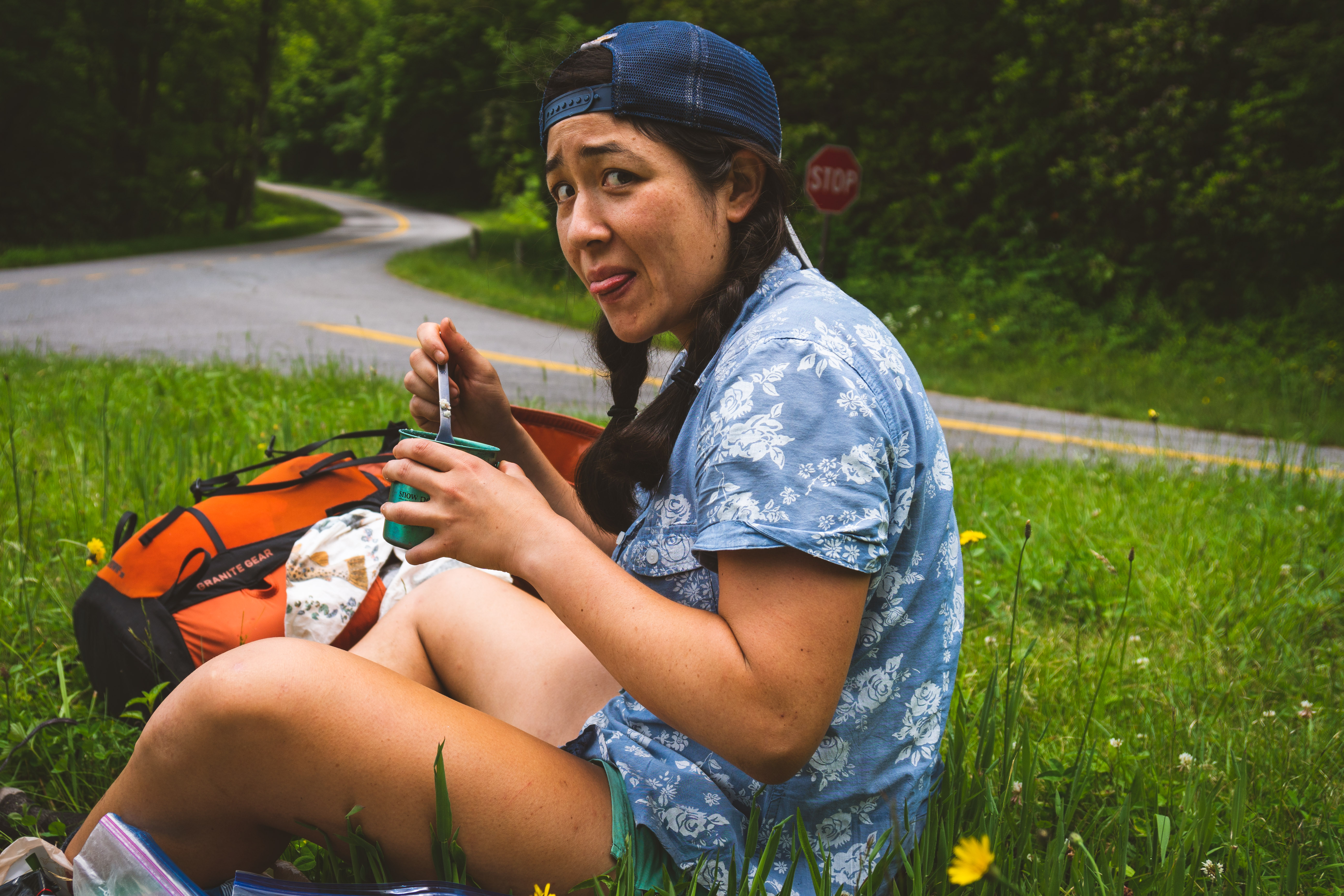
We continued hiking throughout the day, only stopping once more for a brief thirty minute lunch break. Seth had been to Balsam before and told me that there was only a post office and a church, not even a gas station, so that I wouldn’t get my hopes up about town food and beverages. But as we got within a few hours of Balsam, my hungry hiker brain took over and I began imagining the absolute perfect scenario: a Friday afternoon church fish fry. One of those good old southern shindigs that’s $5 a plate, $10 for all you can eat. I dreamed about that fish fry the whole time we were hustling down the descent into Balsam, which could be what caused me to roll an ankle and fall into a cluster of nettles.

SO GREEN
We got caught in a rain deluge, forcing me to don “vomit poncho,” an affectionate term that I developed for the dang thing because it never dried out from the tropical storm and had become impressively odorous. Flecked with small pieces of soggy dead leaves and who knows what else, it left a nice damp residue on my arms after I removed it. We made it to the post office at 3:30pm! When Seth, dripping wet and wild eyed from the rushed pace, picked up the two packages at the window, he explained to the clerk that he was a hiker picking up the two boxes that we’d mailed. He offered to show ID, but she said it wasn’t necessary because she believed him.
Since there was a sign outside the post office that said loitering on the property was a federal offense, we sat down right across the street under a tree that blocked the drizzling sky. As we opened the boxes and delighted in all the foods we had packed for ourselves, two realities set in. One, the was no church fish fry. Even though it was a long shot, I was still bummed. And second, I’d woken up with pain in my left shin but ignored it throughout the grueling day of hiking since we had to make it to Balsam in time. Now that I finally had a second to assess, it was clear that the shin wasn’t happy. Any dorsiflexion more than a few degrees caused pain from my ankle up my shin. Spoiler alert: this injury was here to stay.
We briefly considered hitchhiking into Waynesville for town food and a shower but decided to save the time and money and continue up the trail. Due to the shin pain, I elected that we camp at the first campsite we came across. As it would turn out, the next little section of the MST was a road walk along the Blue Ridge parkway, that led to another road walk up a gravel road. We slogged up three more miles, and finally found us a suitable campsite.

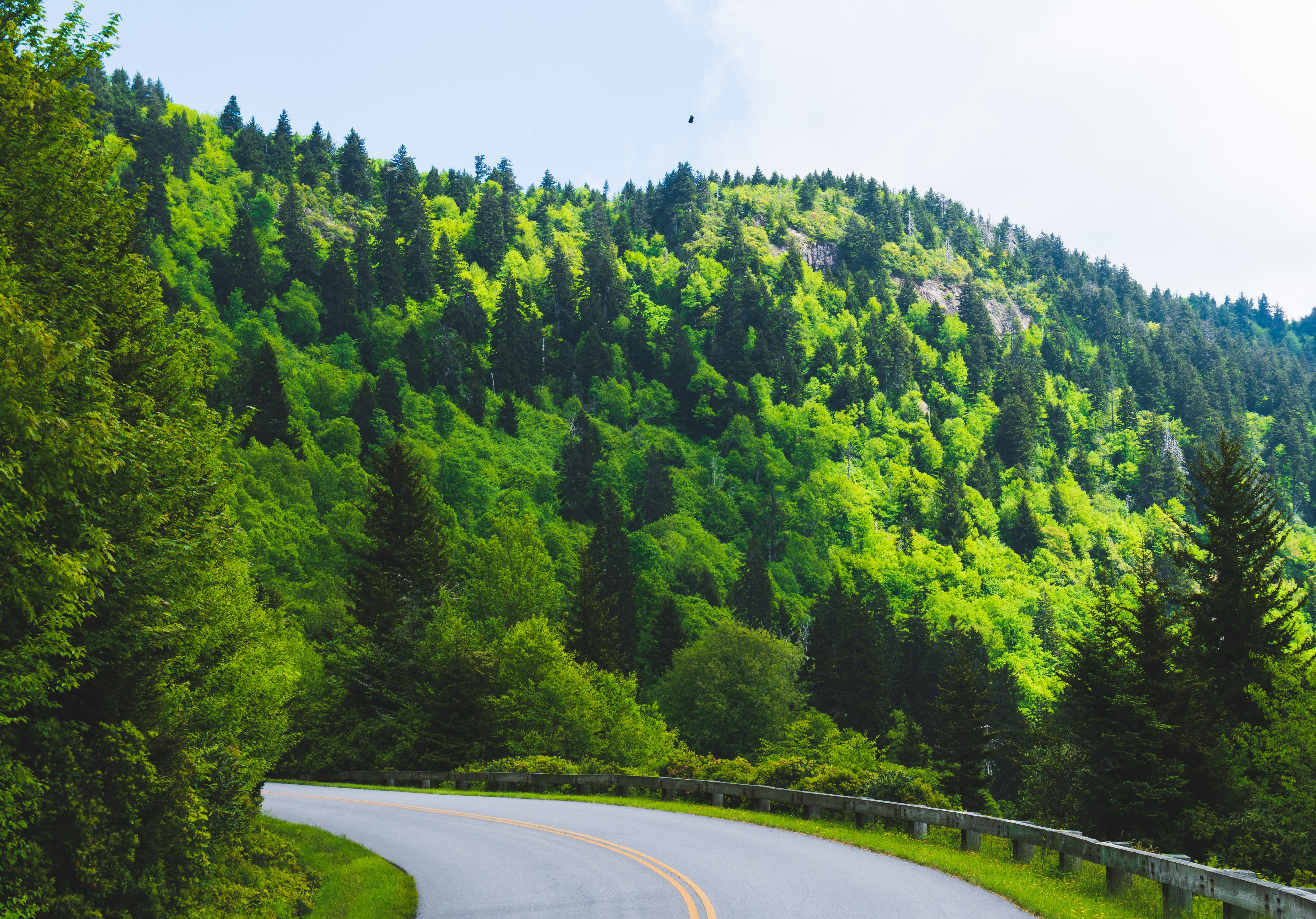
The morning hiking was a breeze, which would prove to be a stark contrast to the afternoon. We cruised on some beautiful trail up and over Waterrock Knob. This was the MST we had been hoping for. Soon after we passed under a neat, artfully graffitied bridge, we intersected a paved road and the white MST blazes disappeared.

Did you ever think there might be hikers staring down at you while you drive the Parkway?
We decided to sit for lunch and bask in some sunshine before figuring out what to do. In a valiant attempt to create a lunch food for myself, I mixed together a salmon packet, some instant mashed potatoes, raisins, red pepper flakes, and salt. Not great. At least I tried.
Ick.
After lunch, we decided to continue hiking straight on the gravel road we’d been on, reasoning that there would have been a blaze indicating any deviation from that path. After fifteen minutes of hiking uphill, we reached the Mile High Campground. This was completely unexpected since it wasn’t on our PDF. We asked the very friendly camp host if we were still on the MST. “I think so? We’ve had ten hikers or so this year come up here.” Not a confident answer. She graciously offered us Mountain Dews, cups of ice, a sleeve of Ritz crackers, and two bananas. As we sat at a picnic table to enjoy cold drinks, we discussed what we should do next. Were we on the MST??
We decided to continue on the gravel road and see where it led. As we were descending, I saw a large animal in the forest in front of us. For some reason, my brain initially thought it was a centaur from Harry Potter. As we got closer, we saw it was a beautiful bull elk! Nice rack.

Not a centaur, but close
After about an hour of hiking we intersected the Blue Ridge Parkway. We hadn’t seen an MST blaze since our lunch spot, and thus were very confused. Where had we made a wrong turn? Luckily, we had cell service at this point. We stopped at a pull-off and used my phone to figure out what was going on. As we munched through the sleeve of Ritz, we found out that there are actually three alternate routes of the MST for this section: a northern route, southern route, and the original route which follows the parkway through the Cherokee Indian reservation. Long story short, the PDF we were following had led us to the original route, but we didn’t realize it’d be a road walk. Shrugging our shoulders, we resigned ourselves to the fact that we’d be walking the road for the rest of the day and a portion of tomorrow morning. It was hot and my shin hurt, but the promise of entering the Great Smoky Mountains National Park tomorrow kept me moving forward.

The hot pavement and zooming cars from yesterday were replaced by misty views and the occasional driver as we enjoyed a peaceful Sunday morning walk on the Blue Ridge Parkway. We gradually descended on the parkway to the Oconaluftee visitor center, located at the entrance of the park.

Is that a leaf on your butt or are you just happy to see me?
Careful not to get our hopes up since the disappointment from the non-existent fish fry was still all too fresh, we reasoned that the visitors center would, at the minimum, have hot coffee. And hopefully an ice cream case. But once again my hungry hiker brain took the reins and by the time we walked up to the visitors center I was dreaming of a food truck selling breakfast burritos.

It should go without saying that there weren’t any breakfast burritos. But there wasn’t even hot coffee! Huge bummer. We contemplated hitchhiking in to Cherokee, only a mile and a half away, for what could be a spectacular diner breakfast. There was a big climb ahead of us and we still had a lot of miles to go for the day, so we made the tough decision to skip out on town food. We walked on to the Mingus Mill trailhead, where we sat on the pavement outside the bathroom and cooked oatmeal. Sigh.
I have spent a lot of time running, hiking, and backpacking in the Smokies, and it has become one of my all-time favorite places. The biodiversity in the park amazes me every single visit. And then there are the views! We hiked gently uphill next to a roaring creek until the trail narrowed and took us up the steep mountainside to the ridgeline above. This climb, which took us from the valley floor up to a ridgeline thousands of feet above us, felt characteristic of the Smokies. I was coming home.

Despite the beautiful trails and backcountry feel of the Smokies, I wasn’t having a great time. The culprit? My left shin. It started hurting progressively more as the day went on. Downhills were significantly more painful than the climbs, so as we dropped back down to another creek, I slowed to a sad, limping 1.5 mph pace. Once we reached Deep Creek, we had about four more miles until the backcountry campsite that we had reserved in advance (camping is by permit only in the Smokies). I gritted my teeth and leaned on the trekking poles as we swatted at gnats and slowly made our way to Campsite 53.

We enjoyed camping with other humans for the first time on this loop. Both of the men we were camping with were members of the 900 club, which means they’ve hiked all 900 miles of trails in the Smokies. One day I’d love to complete the impressive feat! Before the trip, I saw something on the internet about the famous synchronous fireflies in the Smokies. Due to high demand, there was a lot of rigmarole about entering a lottery to get an Elkmont campground pass to see the fireflies. No thanks. Seth got out of the tent briefly right before we fell asleep, and immediately popped back in to tell me that the fireflies were in our little campsite! I’ve never seen anything like it. The whole field was full of fireflies, who would all flash in sync with each other and then go dark before starting another round. If you’ve seen Stranger Things, it almost felt like we were in the Upside Down. We craned our necks out of the tent for a few more minutes enjoying our personal show, and then curled up to rest our tired, aching bodies. More hiking in the morning!

The day began with a river crossing, which I was determined to take full advantage of. Halfway across in the deepest part of the river, I kneeled with my backpack still on and bathed my body from the waist down. I started the climb up to the Appalachian Trail dripping wet, but at least I was cleaner! The Fork Ridge Trail was relatively mellow, and before we knew it we’d reached the junction with the AT. I love this part of the Smokies. The high elevation ridgeline is covered in Balsam Fir and Red Spruce trees and accented by delicate, hypergreen mosses. What a magical place. I was in heaven!

When I go hiking in my dreams, this is where I go
In yet another attempt to get some sort of food other than what we were carrying in our packs (sensing a theme?), we turned off at the Clingman’s Dome summit and walked half a mile down the paved tourist trail to the gift shop. They had to have a snack bar, right? Wrong. After taking a lap through the gift shop looking for anything resembling ice cream or lemonade, we chatted with one of the volunteer rangers for a few minutes before heading back up to the trail. Seth bought a white chocolate bar and some trail mix as a consolation, which we had finished completely by the time we’d climbed the half mile uphill back to the AT. We passed an older couple birdwatching, who were using binoculars to look at a bird just four feet away. “Ah, look, it’s a cedar waxwing!!” Ha!

Double Spring
Soon we stopped for a brief lunch break at the Double Spring Gap shelter. This was the turning point of the day for my shin. Up until this now, the hiking had been almost completely uphill and thus the shin felt fine. After lunch, however, we started descending and ascending along the ridgeline. It started to flare up and became impressively painful by the late afternoon. Even though this was a gently undulating section of the AT, my limping made it difficult to enjoy the sun dappled trail and soft breeze through the trees.
We stopped in the Derrick Knob shelter for one last snack break before the final five or so miles before our campsite reservation at the Spence Field Shelter. While hanging out and resting our legs in the shelter, we enjoyed talking with two very friendly women, a seasoned Smokies backpacker and her aunt. When we told them that we “only” had five more miles to go before calling it a night at the Spence Field Shelter, we were met with a noticable silence from the previously chatty women. They had just hiked from that direction, so I should have taken it as an indication of the difficulty of the section. Instead, we packed up and soldiered on, blissfully unaware of how hard the next two hours would be.
I was excited for this section because we were going to summit Thunderhead Mountain. This past winter, I was lucky to witness many sunsets atop Mt Le Conte, one of the flagship mountains of the Smokies. While waiting for the sun to drop below the horizon, bitter wind stinging our cheeks, hands wrapped around a thermos of hot tea, Seth would call out the names of mountains far off in the distance. Thunderhead was one such mountain, and I often commented how I wanted to hike it one day. Well today was the day, and what a climb it was.
The trail suddenly lost its gentle slope and pitched steeply up a mountain. We chugged along, breath becoming increasingly labored. When we reached the top, Seth checked his watch against the mileage and commented that we were making good time. Thunderhead conquered! That meant we only had one more mountain to go, Rocky Top, before rolling in to our campsite.
But it’s the AT, and we should have known better. The trail dropped steeply down off the high point, causing my shin to light up. At the bottom of the descent, the trail went straight back up! And low and behold, when we got to the top almost an hour later, we read a geological marker that said “Thunderhead Mountain.” Turns out we were moving much slower than we realized. This was going to be a long haul to the campsite.
The climb to Rocky Top was steeply similar. Upon reaching the summit we could tell it was a bald with spectacular views in good weather, but unfortunately it was socked in. After hours and hours of increasingly painful hiking, I was ready to be done and give my shin a break. We knew the campsite was only a couple of miles from Rocky Top, so we put our heads down and prepared to finish up the miles for the day.
All of a sudden, we came upon an older man sitting in the trail who’d gotten turned around and was out of water. He did his best to explain that he was day hiking and needed to make it to the Bote Mountain Trail, but his speech was a bit slurred and he didn’t seem completely with it. We didn’t have any water to give him, but Seth hung back with him to keep him talking and moving as I limped on ahead.

Here there be wild boar
At one point, I turned a corner and saw three huge wild boars in the tall grasses right in front of me! Each of them had tusks and weighed probably three hundred pounds. Seth and the old man soon walked up, and Seth and I shared a nice “ummm….?” moment before the boars turned and scampered into the trees. The man didn’t seem concerned at all about the boars, which indicated his cognitive impairment.
The next little section of trail was lined with tall bushes, and I could hear the boars snuffling around in the woods behind the bushes. On edge because I was sure they were going to burst through the bushes at any moment, I stumbled into a clearing with a beautiful view of the sunset afterglow on layers of mountains in the distance. Even when in pain, exhausted, and fearful of wild boars, the Blue Ridge mountains sure are beautiful.

We finally made it to the Spence Field Shelter after 9pm. Seth took all of our water bottles, including the old man’s, to fill them, while I got started on prepping dinner. When Seth returned with the water, he excitedly told us that he’d had another run in with a boar. The old man didn’t drink any water, and despite Seth urging him to spend the night in the shelter, the man insisted on hiking the five miles down to the road. In dark wilderness. With wild boars on the loose. We hope he survived the night.
After eating a quick dinner, we laid down on the lower platform level in the shelter (upper level was already occupied). I drifted off to sleep pondering the very disturbing image of a wild boar walking into the shelter to sniff my sleeping head.
When I awoke in the middle of the night to go pee, I stood up and was alarmed to find that my shin and ankle had tightened up so much that I could barely walk out of the shelter. When I inched back into my sleeping bag, I whispered to Seth that I needed to drop from the loop the next day. This did not come as a shock to him, since I’d been miserable for the last couple of days. In fact, he later told me he was relieved that I’d finally decided to call it quits. We quickly developed a middle of the night contingency plan. There were 48 miles left in the loop, and only 18 miles left to the next road crossing at Fontana Dam. We would hike the 18 miles to Fontana Dam in the morning and stay in the “Fontana Hilton,” an impressive AT shelter next to Fontana Lake that sleeps twenty hikers. Then, the next day, I would hitchhike to the Nantahala Outdoor Center (NOC), where we started the loop, while Seth hiked thirty trail miles to get there.

When I woke up, Seth had already prepared a morale boosting ramen breakfast. We spent half an hour getting my ankle loosened up enough to hike and experimenting with different tape jobs to try to alleviate even a little bit of pain. It’d been swollen for two days, but this morning it was noticeably red over the most inflamed area. Time to get out of the woods. Even though I’d made the decision to quit, we still had 18 miles, most of which were downhill, to get to a place where I could actually quit.
We took our time during the morning of hiking, stopping at each shelter for me to put my legs up the wall in an attempt to combat the swelling. I spent the morning reflecting on all the things that went wrong for me this trip – ill-fitting pack, heat rash, right calf pain, UTI, and now trip ending left shin pain. If I learned any lesson about myself, it’s that I’ll look for every excuse not to quit.

Fontana Lake from above. I can almost see the burgers from here.
The last six miles were a continuous, often steep downhill. Very painful. We finally made it to the Fontana Hilton, signaling a glorious end to the limping. The whole Fontana Village resort area is incredibly hiker friendly, so we called a shuttle phone number posted on the bulletin board and were picked up in the back of a pickup truck within five minutes! First on the agenda was burgers, a beer, and five cups of lemonade. Feeling physically full but still in emotional need of more town sustenance, we walked (I limped) down the hill to the ice cream shop. It’d been a long seven day stretch in the woods with only backpacking food, and we were determined to soak in all the caloric comforts of civilization.

Walking on the Dam road
The next day, I successfully hitchhiked the hour drive to the NOC, and Seth hiked the remaining thirty miles in ten hours.

Yay!
The SALT was one heck of a loop. It tested us physically. We dealt with gear malfunctions, a tropical storm, injury, and navigational uncertainty. Even though we were often relatively close to towns, the loop retained an adventurous feel since there were no other thru hikers out there with us (to our knowledge). There was a good bit of road walking, and not all of the trail sections were beautiful, flowing singletrack. But for hiking enthusiasts who have spent a lot of time in the woods around here, the SALT was an epic linkup of some of our favorite places in the world.
If you’ve followed along for all three chapters, thank you! I regret to inform you there’s no prize or pot of gold, which must be why you’ve read to the bitter end. As a consolation, here’s a list of lessons I learned on the trip as I wrote in my trip journal debrief:
– Bring some kind of pants. Judging by all the gear and clothing items I used in camp or while sleeping, I definitely should have brought long underwear or something. Tent rain fly, tent body, two jackets, trash compactor bag, pack…they’re all not great substitutes for pants.
– Do not compromise pack comfort in pursuit of ultralight-ness. In the future, focus on a comfortable pack with ultralight elements that can haul if necessary, and choose to be ultralight with other gear.
– When trip planning, keep daily mileage at 20. The mileage for this trip was simply too ambitious for two hikers not in thru hiking fitness. I think we knew this beforehand, but now we really, definitely know.
– Start trip with shoes that will hold up for the duration. This one seems obvious, but apparently it was not.

Made it to the wedding in time, just three short days after finishing the loop! Thank goodness it was a long dress!
Seth took all of the great pictures in this blog post! Check out his photography website here. I took all of the poor quality iPhone pictures. I don’t have a photography website, sorry.

